


CivicWell works closely with local communities on outreach and engagement, collective visioning, and planning for projects and strategies that increase community resilience. We offer a variety of options to meaningfully engage stakeholders and community members in co-creation of planning, design, and land use decisions. Our process is collaborative, and centers equity and resilience.
Community Design Charrettes
CivicWell conducts multi-day charrettes to assist with community visioning and planning. Our charrette process includes a series of meetings, workshops, walk audits, and design sessions that engage stakeholders and residents in identifying problems and developing solutions.
We assemble a multidisciplinary planning and design team based on local factors. Community partnership and public participation is embedded in every step of the process. A design charrette integrates feedback from those who live, work, and go to school in the community—the experts. The design team’s function is to first facilitate and listen to the public, and second to distill a common vision and design solution. Community input is gathered in a number of ways:
- The design team works with an advisory group representing key stakeholders. Participants typically include agency staff, businesses, community service organizations, and school representatives.
- Small focus group meetings are conducted for interest groups to provide candid input. These meetings also provide an opportunity to reach non-English speaking stakeholders or historically marginalized community groups.
- Facilitators provide presentations to inspire people with ideas, strategies, and success stories from similar communities.
- Field condition inventories (walkability audits) offer participants the opportunity to tour the project area with walkable communities experts to identify strengths, weaknesses, and opportunities.
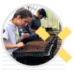
- Participants work at design tables with their neighbors, and write and draw ideas for improving safety, access, walking, bicycling, and transit in their community. Using maps, pencils, and good communication, the public can come up with solutions to complicated issues.
We work closely with staff and community partners to conduct outreach to the entire community. And in the months that follow, our multidisciplinary team will produce a visual report that covers the public process and resulting vision and recommendations.
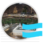
Our team has conducted charrettes in over 35 communities throughout California on planning and design issues such as pedestrian and bicycle safety; street design; traffic calming; neighborhood, downtown and corridor revitalization; Safe Routes to School; and strategies for new development.
Mini-Charrettes
Smaller planning areas may not need a full charrette process. An alternative for these locations is to conduct a 3-day mini-charrette followed by a closing presentation to share the plan. A mini-charrette typically includes a longer opening workshop (approximately 4 hours) and 2 to 3 focus group meetings. A walkability audit can also be included. The design team generally includes a facilitator, urban designer, transportation planner or traffic engineer, and an illustrator.
Community Image Surveys
The Community Image Survey is a tool for helping decision-makers and their constituents address community design, land use, and transportation issues. Based on the Visual Preference Survey™ developed by architect Anton Nelessen, it uses images to help participants evaluate their existing environment and envision their community’s future. Tailored for the needs of each community, the survey provides a foundation for planning and implementation efforts.
The Community Image Survey is often administered at a public meeting or workshop, and participants are shown slides and are asked to rate each slide based upon how much they like or dislike the image. Several hours later (or at a follow-up event), the images can be shown again with their median scores. Participants then discuss each image, providing useful input to policymakers.
After learning about land use alternatives, community members can then develop a common vision of the physical characteristics they would like to see in the future design of their community. This vision can then be incorporated into the community’s zoning ordinances, design guidelines and planning documents.
As a citizen participation tool, the survey process empowers residents to become part of the community planning process, and educates them about the compromises inherent in design and land use decisions. Our team can administer a survey tailored to your community, train local staff, or give you advice on administering your own survey.
Contact Us
Reach out to us today to see how we can partner with you.